

The world turned upside down?
From Antarctica, the other continents and the rest of the world don’t seem quite as familiar! Antarctica is quite distant from much of the world because of its isolated position in the Southern Ocean. Explore the activities below to see just how far some familiar places around the world are to Antarctica’s icy continent!

All maps are biased pieces of information. In order to make a traditional map the spherical Earth has to be transferred to flat paper. The Earth cannot be flattened out without distortion and therefore every map needs to be amended and is subjective.
The maps below are oblique Mercator projections which emphasise Antarctica. The Mercator map is a well-known world map which distorts the size of objects as latitude increases from the Equator towards the poles.
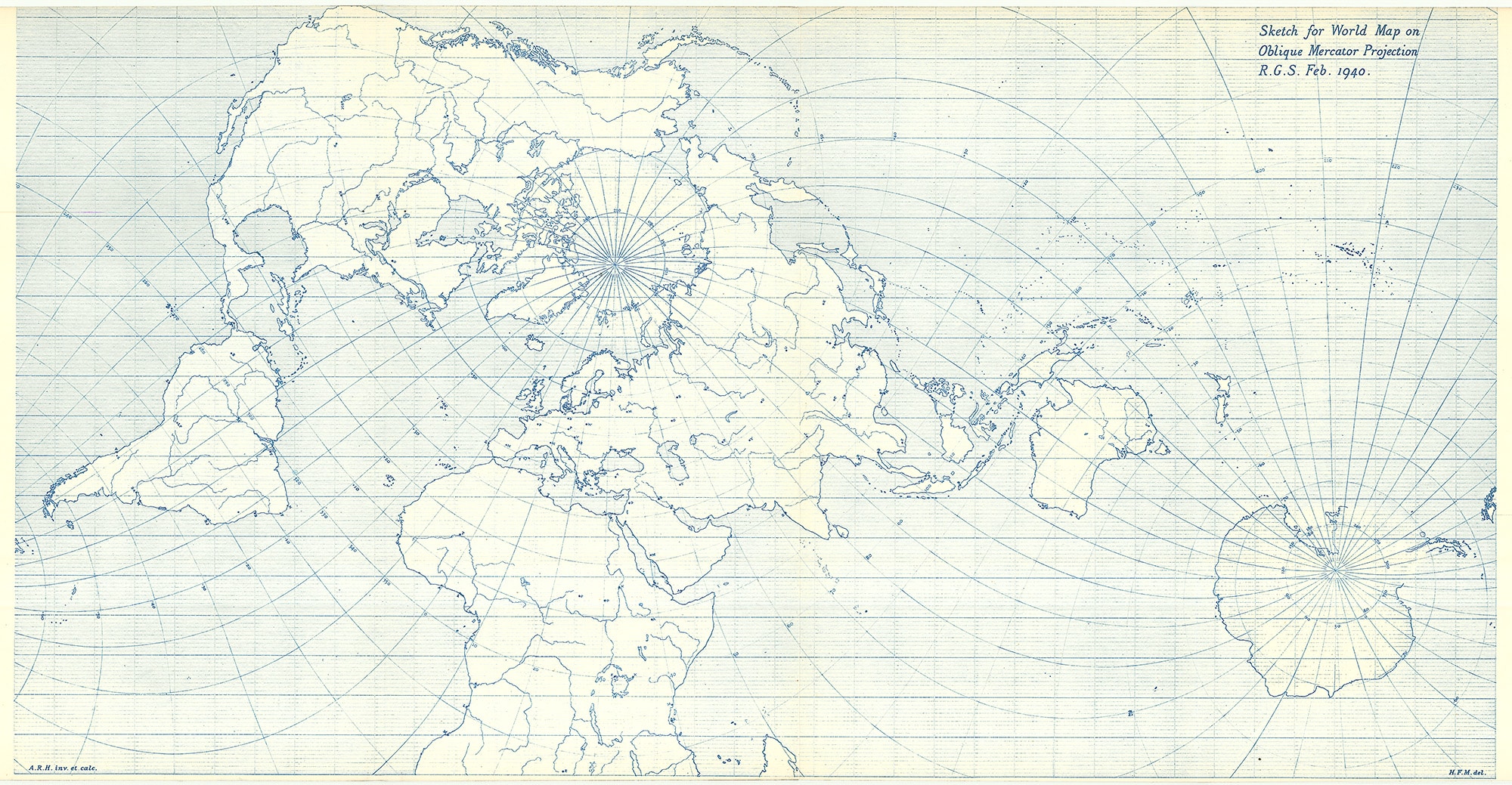
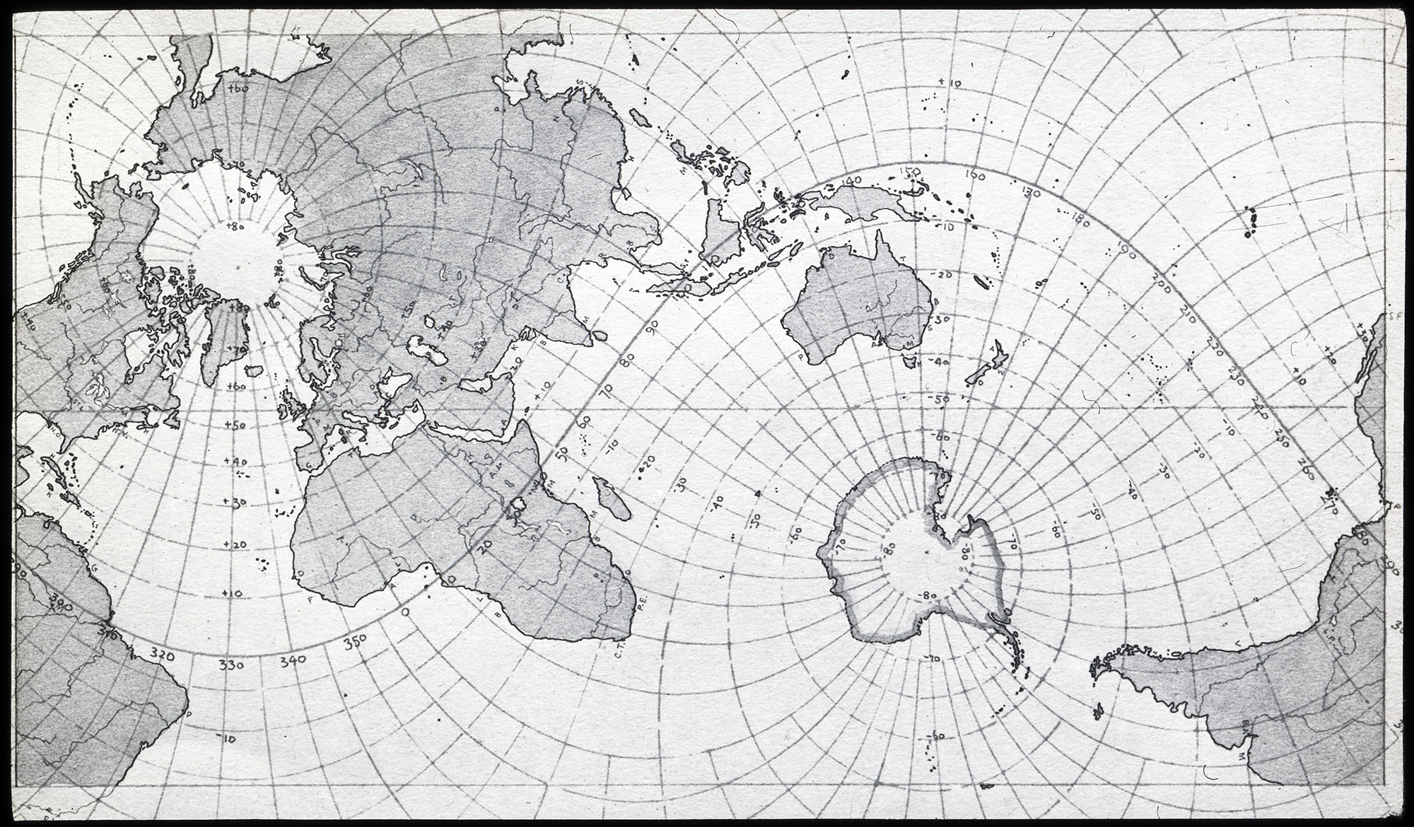
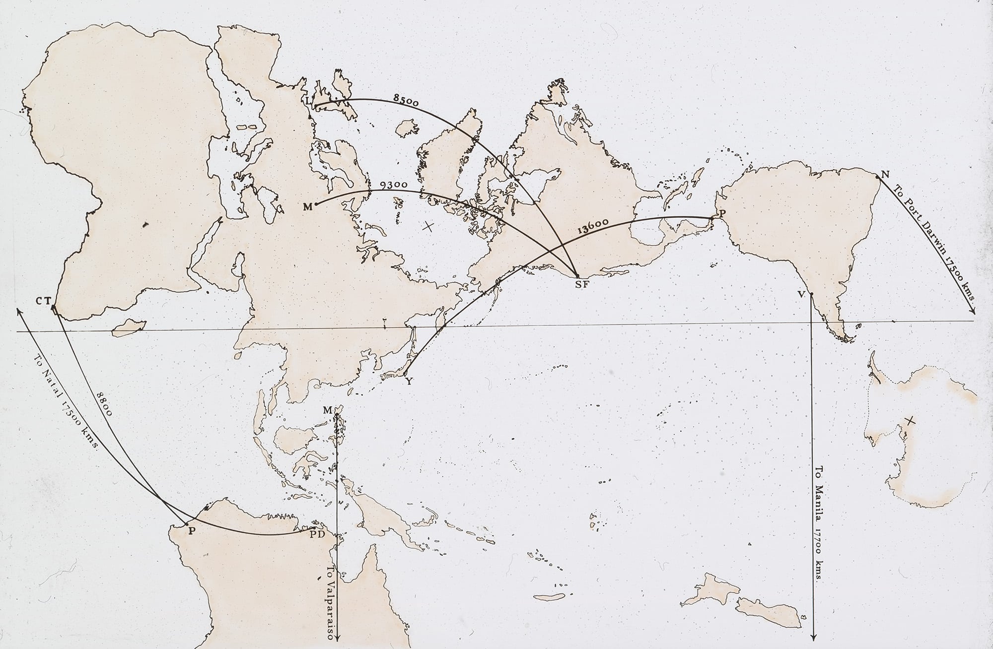
The first map is from the 1940 lecture ‘Maps of the World on an Oblique Mercator Projection’ by Arthur Robert Hinks (RGS-IBG Secretary from 1915-1945), it can be read here. The second and third maps are extracted from Hinks’ 1941 paper ‘More World Maps on Oblique Mercator Projections’, from page 353 onwards.
