
What are glaciers?
A glacier is a term used to describe a mass of ice formed from compressed snow, that moves under its own weight. Glaciers move very slowly and are sometimes referred to as ‘rivers of ice’.
Glaciers
Glaciers can come in lots of different shapes and sizes from small glaciers found in mountainous regions which may only be a few meters wide, to large glaciers which stretch over hundreds of thousands of kilometres.
Let’s explore several different types of glaciers which you may find in the highest latitudes, or the highest altitudes, all around the world.
It is best to divide glaciers into two different types 1) constrained glaciers, where the ice is constrained by bedrock and surrounding topography, and 2) unconstrained, where glacier ice is able to flow over vast areas of land.
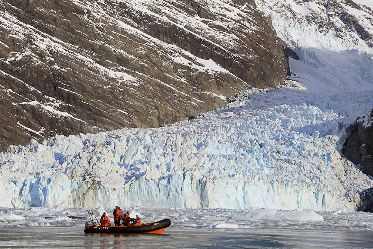
Constrained Glaciers
These glaciers are typically found in mountainous regions, and are controlled by the surrounding topography. Some examples of constrained glaciers are:
Ice Fields
These are expansions of ice less than 50,000 km2 and are shaped by the morphology of the landscape around it.
Outlet Glaciers
Outlet glaciers are channels of ice which flow out from ice fields or ice sheets. These are constrained by the valley walls either side of the glacier which helps maintain its width.
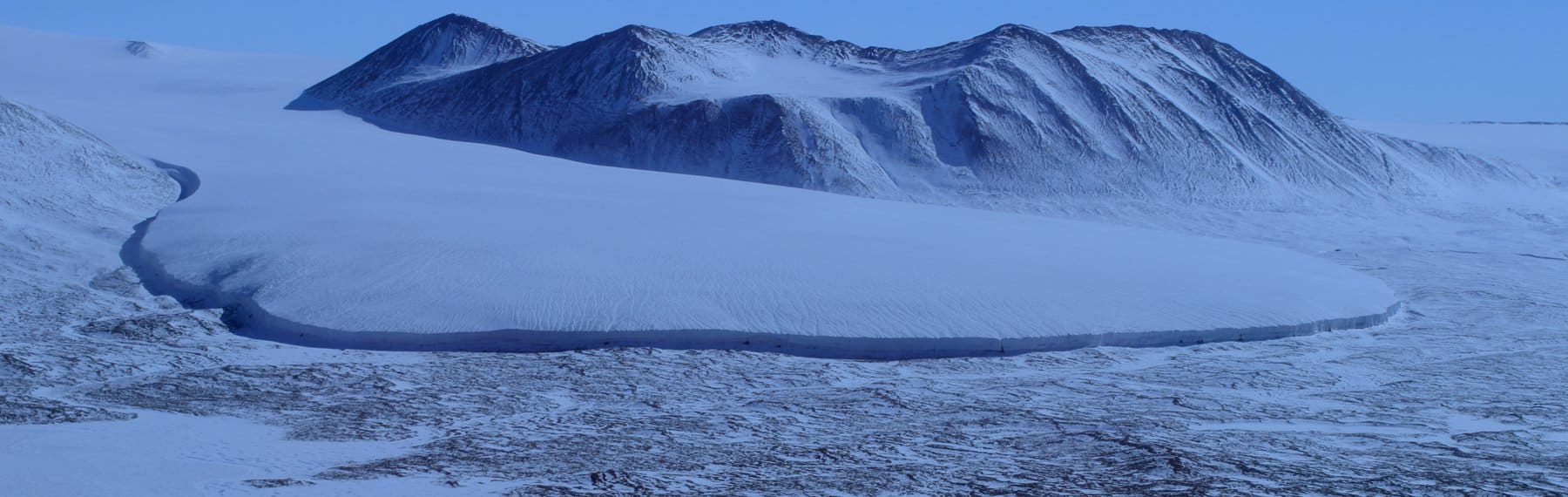
Cirque Glaciers
Cirque glaciers are masses of ice formed on the side of a mountain and forms a bowl-shaped depression in the rock. Sometimes, if these continue to grow and move down the slope these can form valley glaciers.
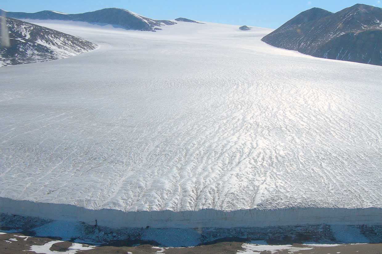
Unconstrained Glaciers
Unconstrained glaciers are masses of ice which unlike constrained glaciers, are not controlled or modified by the surrounding topography or bedrock. A few examples of unconstrained glaciers are:
Ice Sheets and Ice Caps
Ice sheets and ice caps are the larges expansions of ice. Ice sheets are greater than 50,000 km in size e.g. Greenland/Antarctica. Ice caps the same as ice sheets, but smaller than 50,000 km and are also not constrained by topography e.g. Vatnajökull in Iceland.
Ice Streams
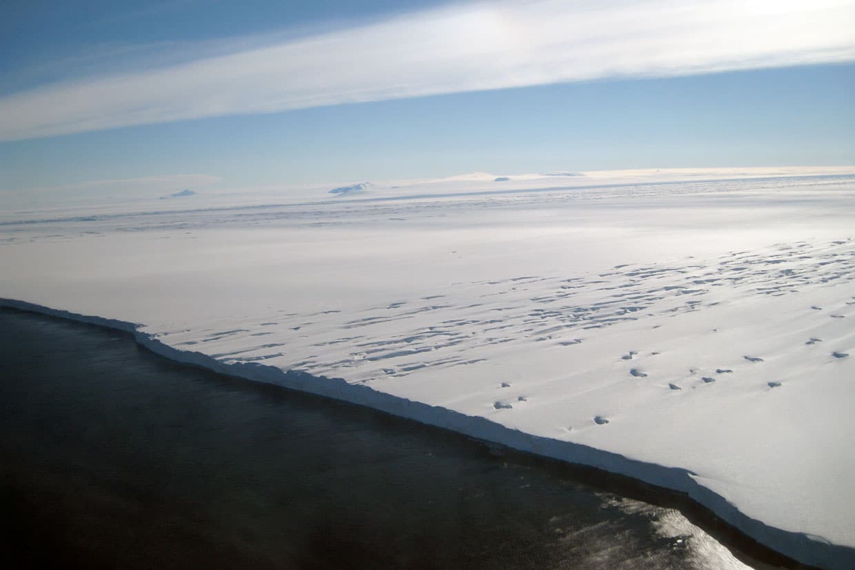
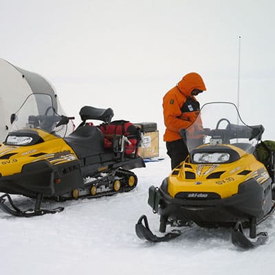
Ice Streams are the fastest flowing bodies of ice. These are typically part of an ice sheet, but are rivers of ice that are flowing faster than its surrounding. Ice streams is the most efficient method of draining ice sheets, providing a direct route to the coastal exterior. For example Pine Island Glacier, Antarctica.
How do glaciers form?
In order for glaciers to form, there needs to be an accumulation of snow. A glacier forms when the layers of snowfall compress together and are squeezed into ice. Once the snow and ice become big enough the glacier starts to move very slowly under its own weight and the force of gravity.
In addition to the snowfall, there needs to be low-enough temperatures to sustain the snowfall and ice formed during the winter all year round. This is why glaciers tend to be found only at high latitudes (polar regions) and at high altitudes (Mountainous regions).
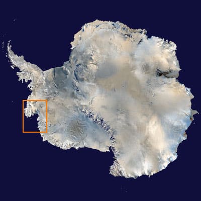
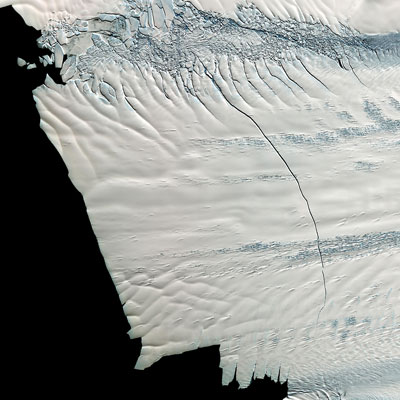
Glacier science: what is happening to Pine Island Glacier?
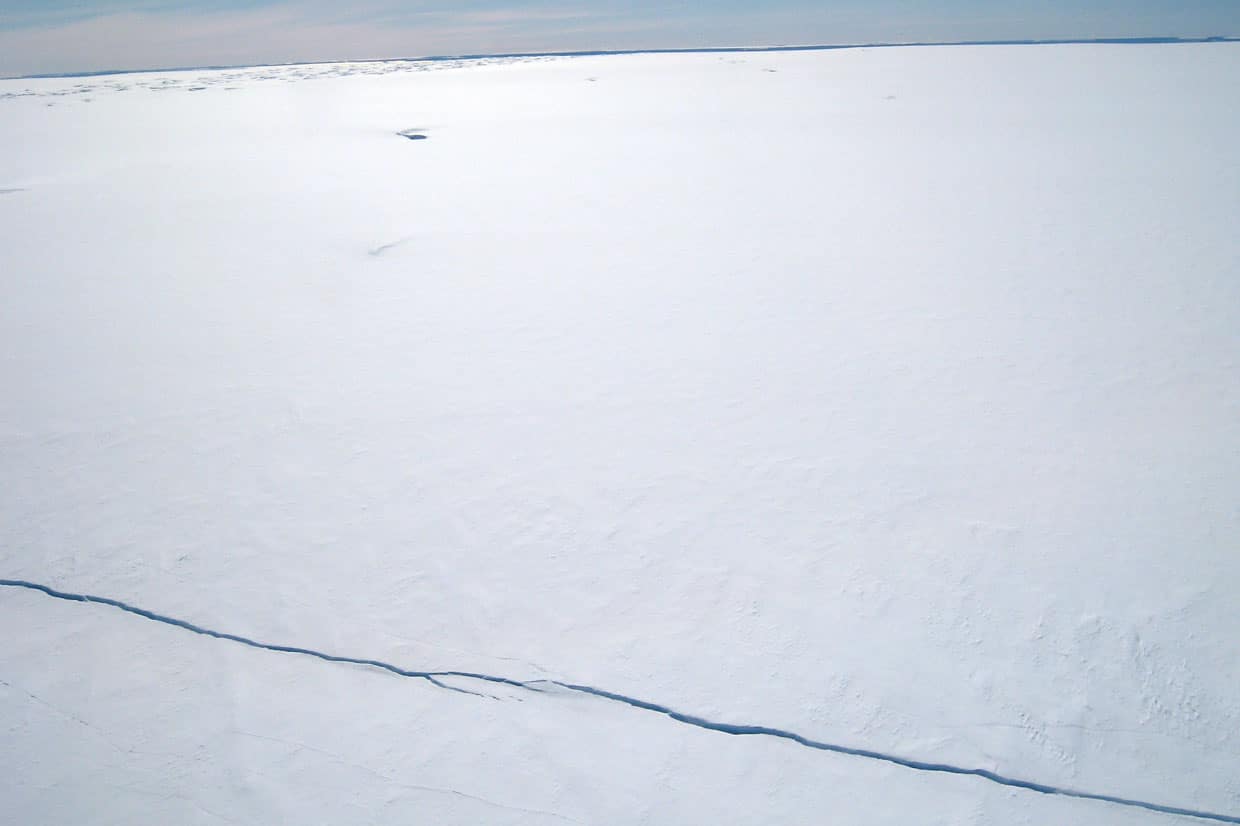
The Pine Island glacier is considered to be one of the fastest-shrinking glaciers in the world. The large mass of ice is only protected from the relatively warm waters of Amundsen Sea by a small ice shelf, and the “cork” in a bottle is disintegrating. The retreat is alarming because the resulting rise in global sea level by 1.5m (out of a total of 3.3 m from the entire West Antarctic Ice Sheet) could occur within the next few centuries
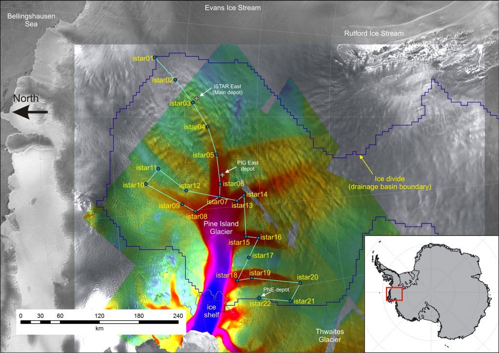
It is around 2km thick but it has been thinning by more than 1 metre each year for the past 15 years. This means it has the potential to make a large contribution to sea level rise, particularly as the glacier is accelerating. In July 2013 a large iceberg broke away (calved) from the ice sheet.
Monitoring this ice stream is therefore very important be try to predict what might happen in the future and to prepare for the potential sea level changes.