1772 - 1775
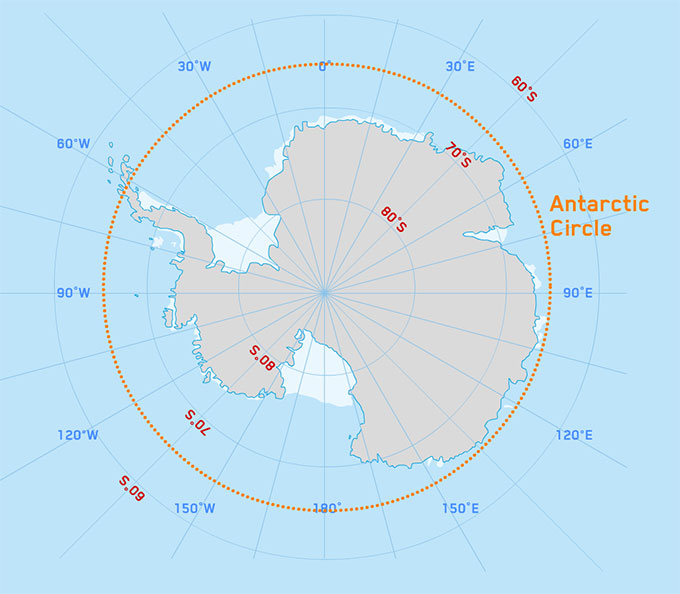
Captain Cook and his crew became the first people to cross the Antarctic Circle.
After crossing the Antarctic Circle they continued to 71˚10’S.

Captain Cook and his crew became the first people to cross the Antarctic Circle.
After crossing the Antarctic Circle they continued to 71˚10’S.
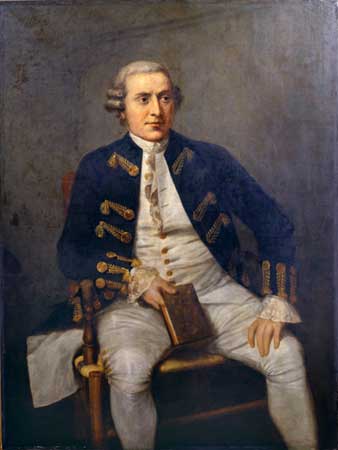
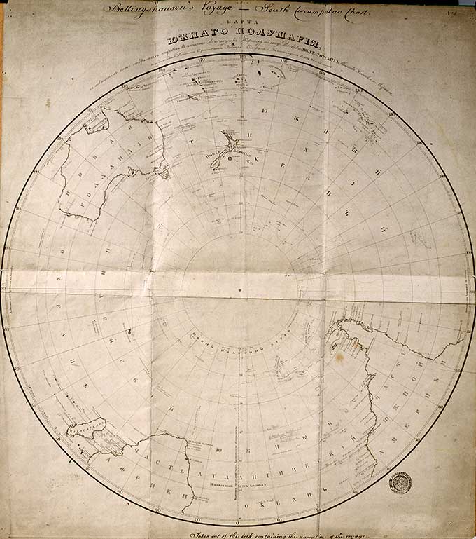
The first ever sighting of Antarctica, by Fabian Bellinghausen (Russian).
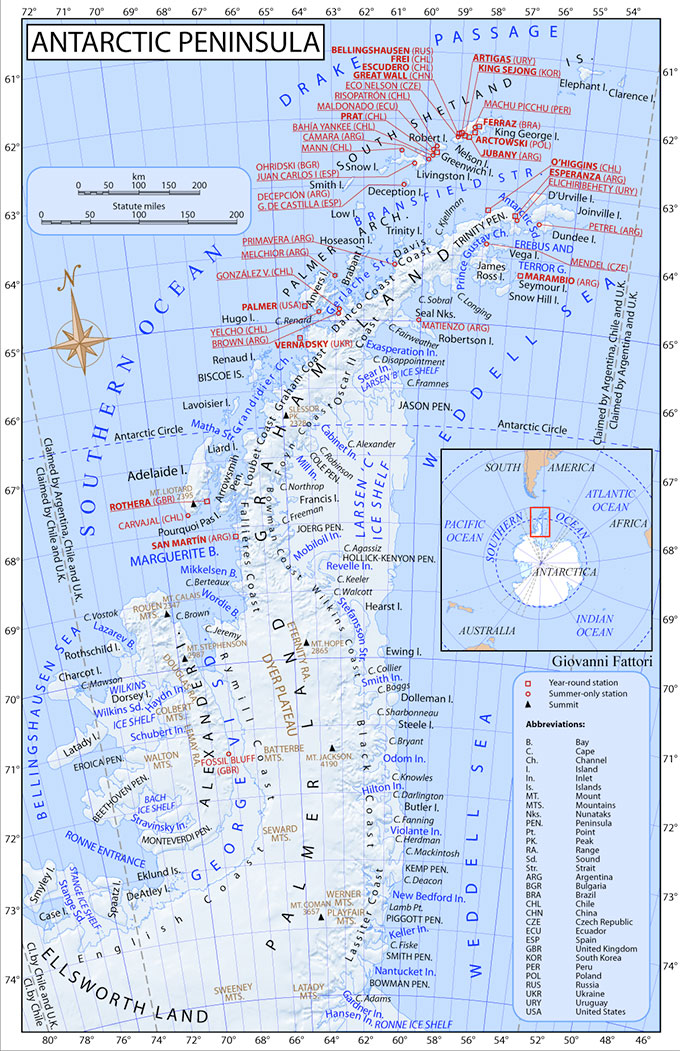
Edward Bransfield and William Smith saw the Antarctic Peninsula.
The Royal Navy sends Edward Bransfield with William Smith (who had discovered the South Shetland Islands) as pilot, to search the waters south-east of the South Shetlands. It is claimed that they are the first to see the Antarctic Peninsula.
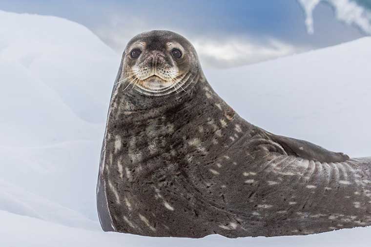
Captain James Weddell sailed to 74˚15’S and found the Weddell Ice Sheet and Sea.
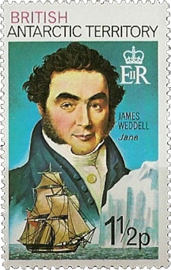
The Weddell seal got its name during these expeditions.
Henry Foster found Deception Island.
John Biscoe found islands around Graham Land.
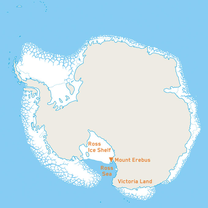
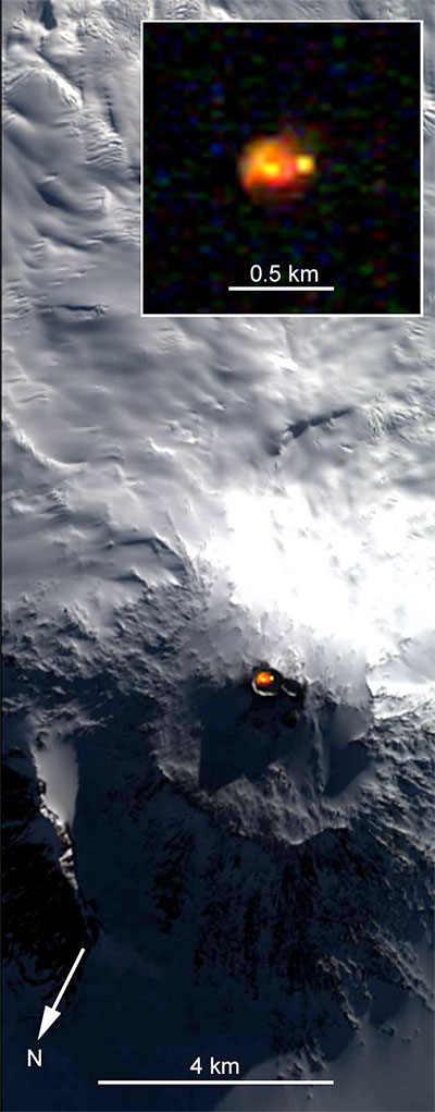
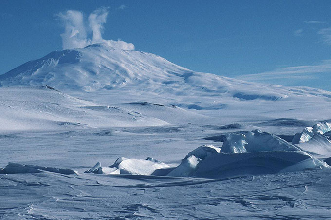
Captain James Clark Ross discovered the coast of Victoria Land, sighted Mount Erebus (which is an active volcano) and found the Ross Sea and Ross Ice Shelf.
Charles Wyville Thompson studied the ocean depths.
Carsten Borchgrevink, a Norwegian, led the British Antarctic Expedition, funded by an English publisher.
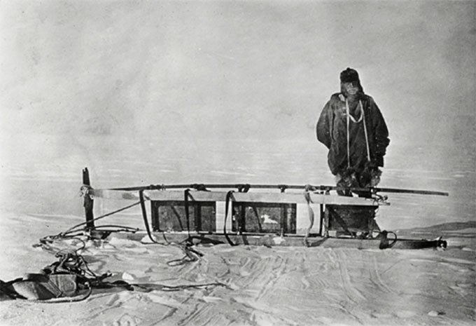
He was the first to overwinter on the Antarctic mainland at Cape Adare. The prime purpose was to determine the magnetic South Pole. He also surveyed the coast of Robertson Bay and collected specimens of birds, fish, seals and penguins. They were the first to use dogs to transport them.
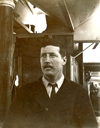
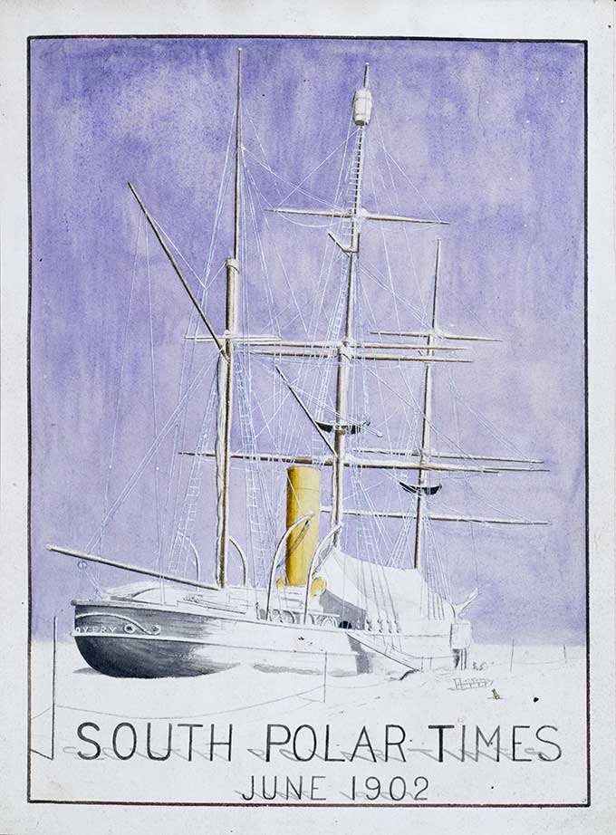
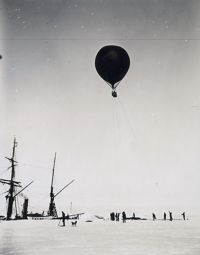
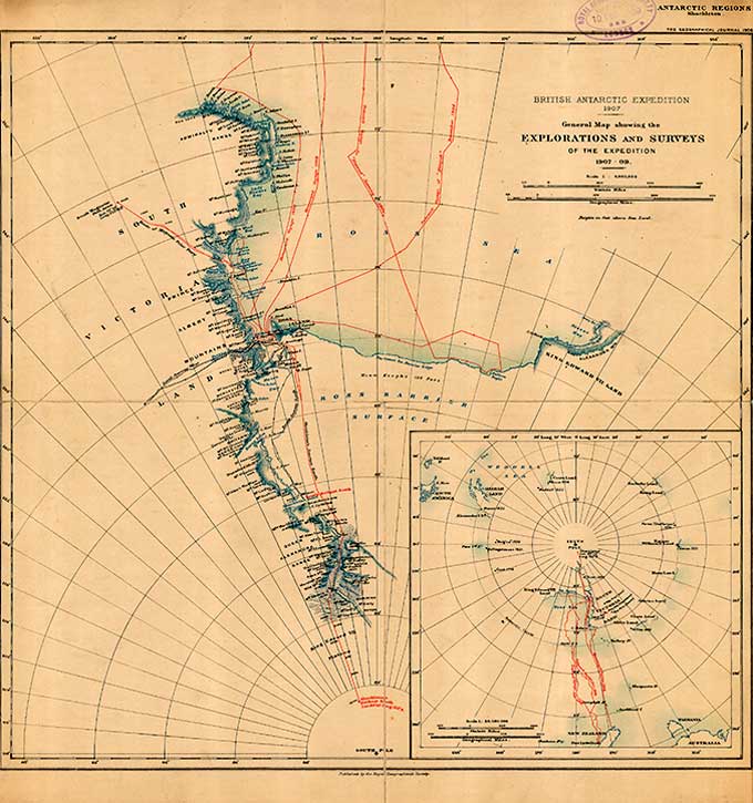
Captain Robert Falcon Scott led the National Antarctic Expedition which was partly funded by the Royal Geographic Society under its President Sir Clement Markham.
Markham and the RGS declared it ‘an opportunity for research and advancement in scientific knowledge concerning magnetism, meteorology, biology and geology’.
The expedition sailed in the specially built Discovery and achieved many ‘firsts’ such as the first aerial reconnaissance by means of a balloon, a journey to Cape Crozier, the ascent of the Polar Plateau and a record journey south by Scott, Shackleton and Wilson. They covered 5,000km until illness and snow blindness forced them back.
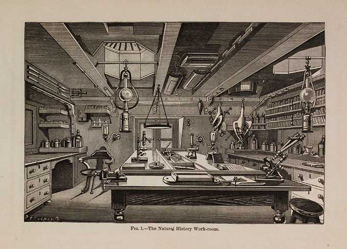
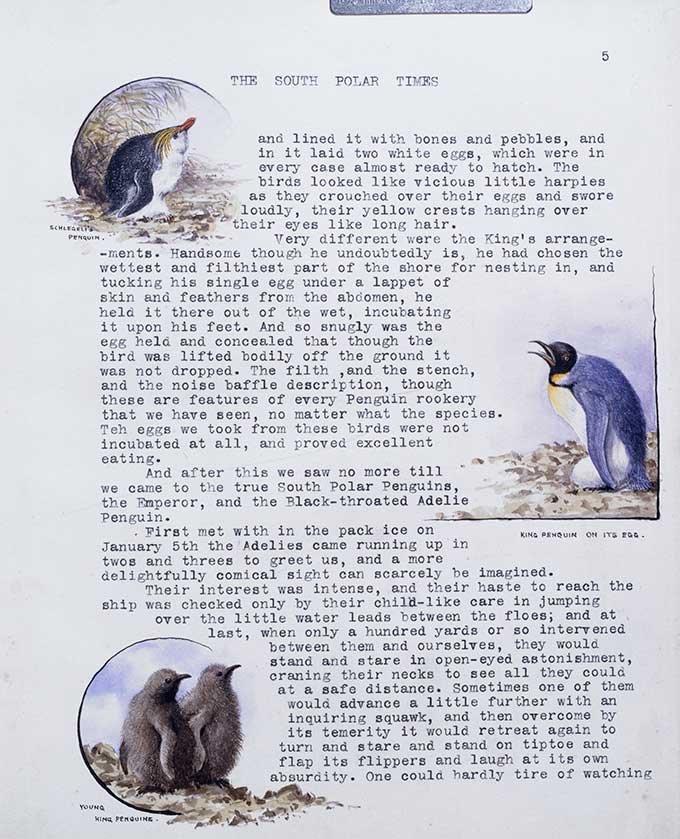
The collections went to the British Museum of Natural History; their statistical material to the Royal Society; and their journal ‘South Polar Times’, written by the men during the long winters, to the RGS.
Scottish Antarctic Expedition
Dr William Spears Bruce led the Scottish Antarctic Expedition on board the Scotia under the command of Captain Thomas Robertson. The expedition was supported and promoted by the Royal Scottish Geographical Society and funded by the Coats brothers of Paisley textile firm.
The primary objective of the expedition was to do extensive hydrographic work in the Weddell Sea during the summer of 1903 and 1904 and to survey the South Orkney Islands and study their wildlife. Despite being stuck in the ice for long periods the expedition discovered Coats Land and the first permanent meteorological station was set up on Laurie Island in the South Orkney Islands.
Otto Nordenskjold a Swedish geologist and five other men undertook the first exploration by sledge.
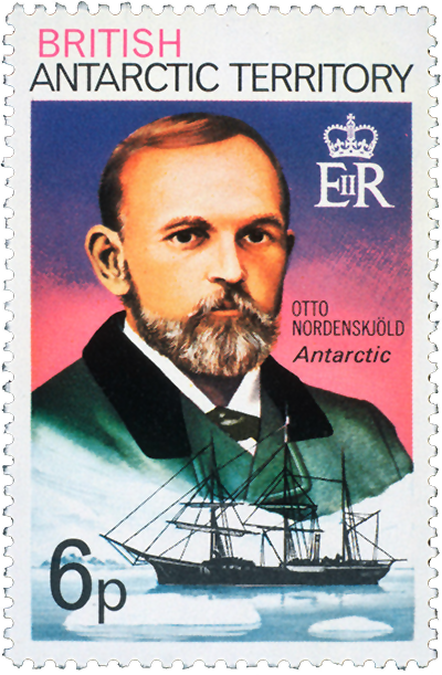
They covered 650 kilometres in the area of Paulet Island and made a winter camp at Snow Hill south of Seymour Island. In the meantime their ship was crushed and they were forced to spend two winters in Antarctica until they were rescued by an Argentinean ship.
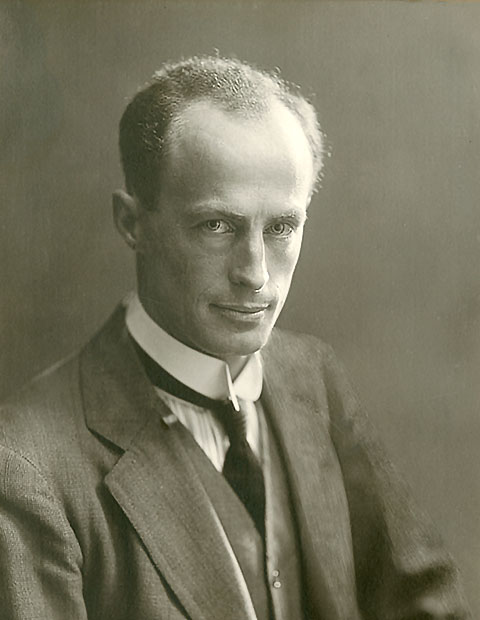
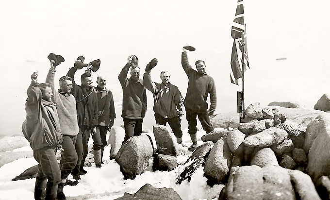
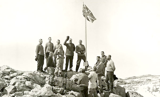
Ernest Shackleton led the British Antarctic Expedition on the Nimrod to try to reach the South Pole, this time accompanied by Frank Wild, Eric Marshall and Jameson Adams.
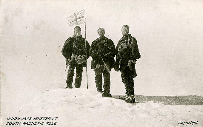
Although they got further than Scott's team, illness and hunger forced them to give up just 180km from their destination where they planted a Union Jack and a canister to mark the point. Work on meteorological observations continued as did studies of penguins and seals. Members of the party were also the first to climb Mount Erebus and to reach the South Magnetic Pole.
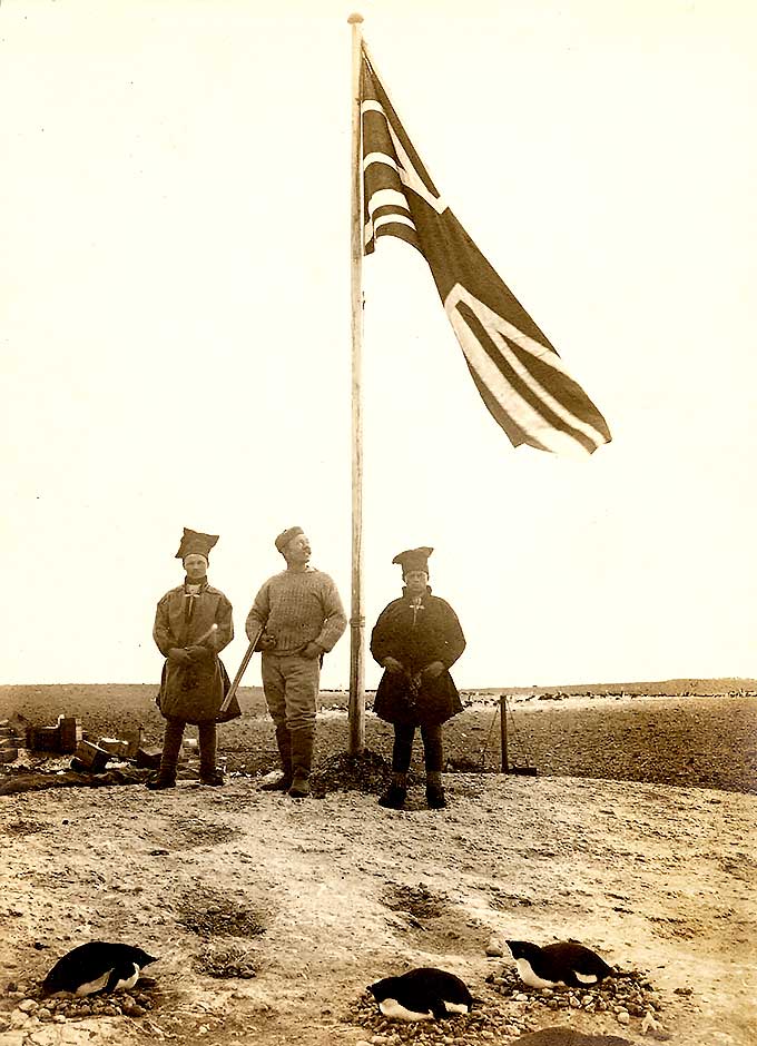
Norwegian Roald Amundsen and four other men were the first to reach the South Pole on 12 December 1911 thanks to a new route that only took them 57 days.
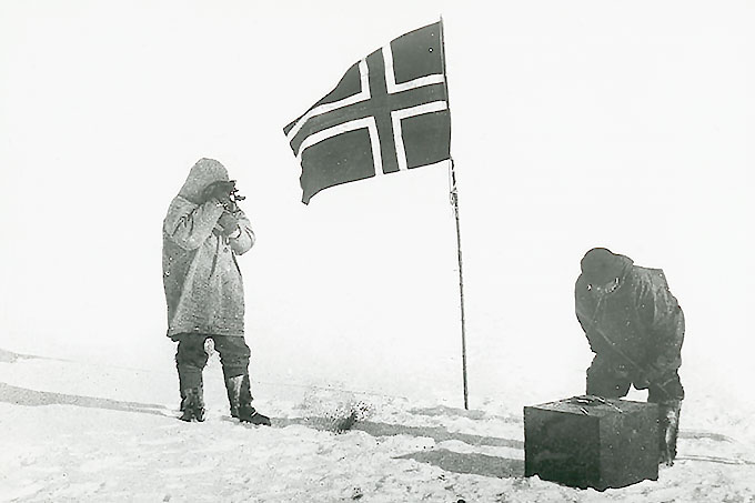
Amundsen planted a Norwegian flag and wrote two letters - one for the King of Norway and one for the British Antarctic Expedition team led by Robert F. Scott. The prime objective of their expedition was to reach the South Pole first: they did little scientific experimentation.
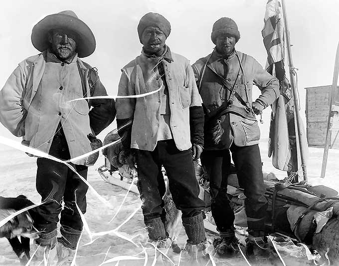
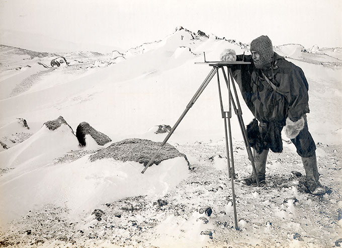
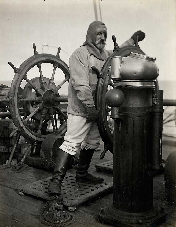
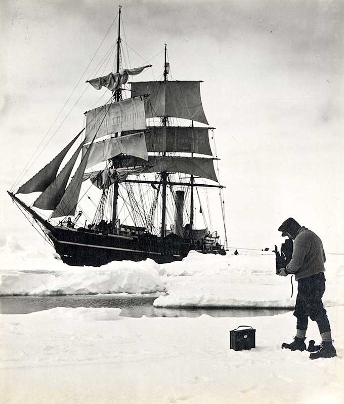
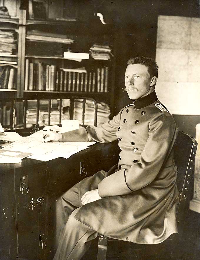
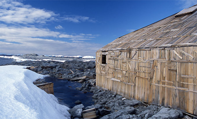
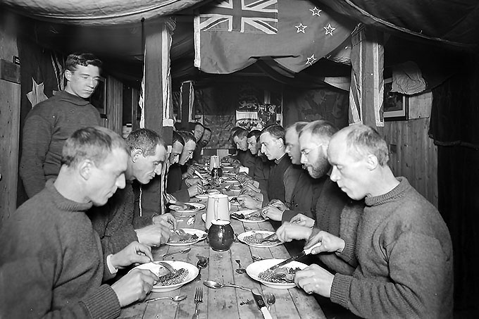
Captain Robert Falcon Scott led the British Antarctic Expedition aboard the Terra Nova with the aim of reaching the South Pole as a major and public objective.
There was also an extensive programme of scientific experiments and explorations. The expedition was led by Captain Scott and included a scientific staff of twelve. From the base camp hut set up at Cape Evans on Ross Island, the scientific staff carried out investigations in a wide range of fields, including meteorology, building on the research of the 1901 - 1904 National Antarctic Expedition.
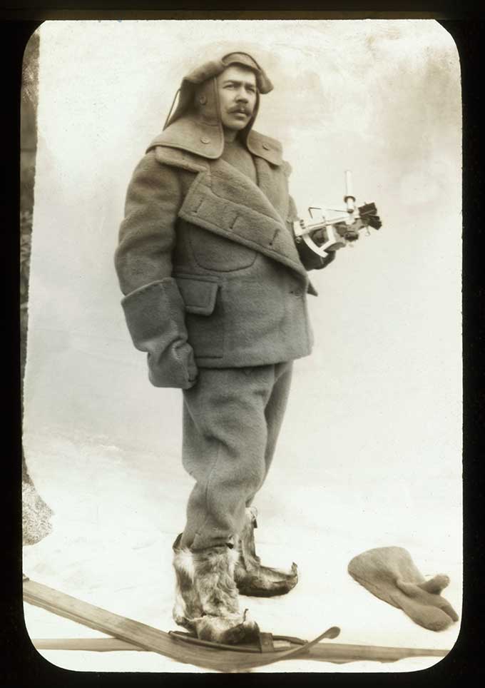
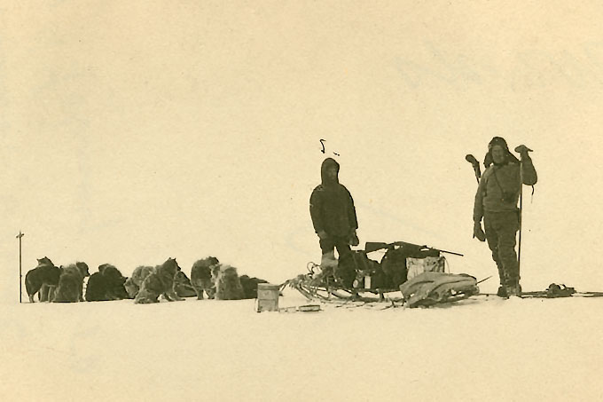
The men used green-tinted goggles to combat snow-blindness, skis and a mixture of ponies, dogs, motor sledges and man-hauling to reach the Pole. The party made up of Scott, Wilson, Bowers, Oates and Evans reached the South Pole on 17 January 1912, 33 days after Amundsen’s party. Bad weather made the return from the Pole increasingly difficult and Scott and his party died only 18 kilometres from a supply camp which might have saved them.
Maps, geological specimens, photographs and diaries were collected from the camp by a search party in the following spring. More about the expedition can be found at unlockingthearchives.rgs.org
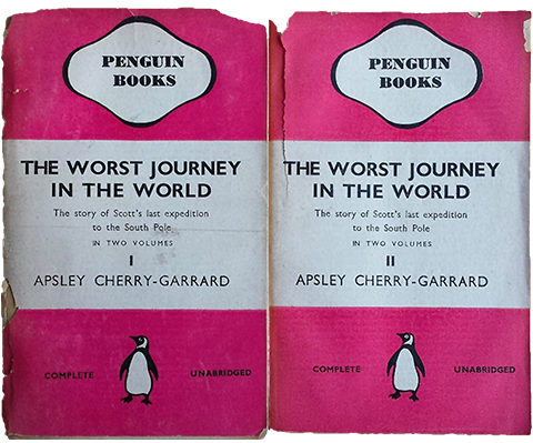
One scientific journey in search of birds, to Cape Crozier, was undertaken during the Antarctic winter and is described in the book: ‘The Worst Journey in the World’ by Apsley Cherry-Garrard.
Wilhelm Filchner’s expedition
Wilhelm Filchner led an expedition on board the Deutschland to determine if Antarctica was a continent. He planned to cross Antarctica but failed. However the expedition did discover Luitpold Land and the Filchner Glacier.
Douglas Mawson led the Australian Antarctic Expedition about the Aurora.
The main aim was to investigate a stretch of essentially unknown Antarctic coastline and to undertake a scientific programme which included an investigation of the ocean and its floor between Australia and Antarctica.
The main base was at Cape Denison in the Commonwealth Bay from which Mawson and two others set off to explore the far eastern area of their survey. Despite atrocious weather, with winds averaging over 60mph, much new information was discovered and new lands surveyed. It was also the first time radio was used in Antarctica.
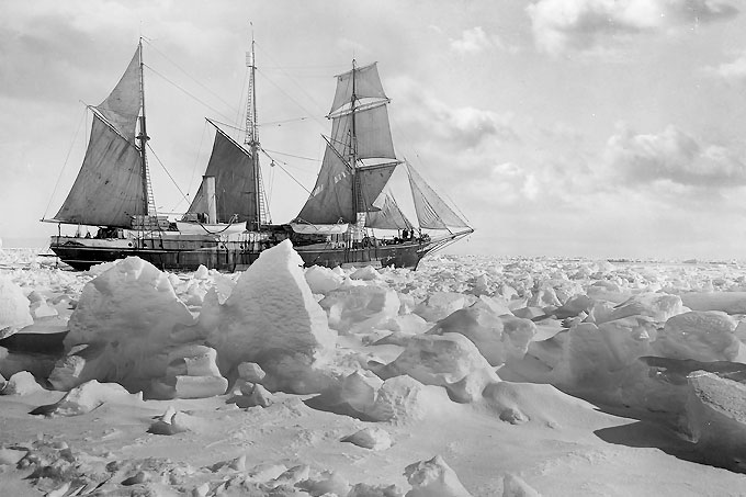
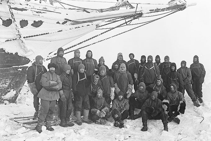
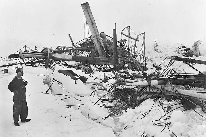
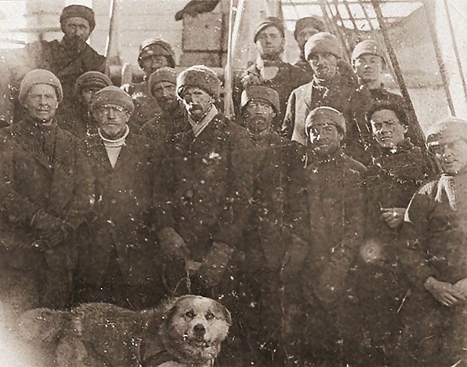
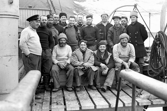
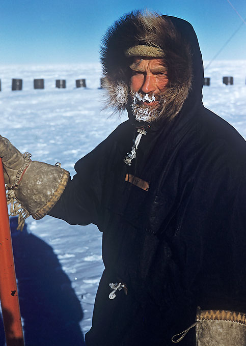
Ernest Shackleton led the Imperial Trans-Antarctic Expedition aboard the Endurance.
The aim of the expedition was to cross Antarctica from sea to sea via the South Pole. It would be an historical event and would also contribute to scientific knowledge as over half of the 1,800 mile journey would be over unexplored territory.
The Trans-Continental party would not be able to carry all their supplies so another group would be based on the Ross Ice Shelf laying depots towards Beardmore glacier. Glacial and geological studies would take place both on the journey and by scientists at the bases.
The Endurance, carrying Shackleton’s party, became stuck in the ice and nine months later eventually sank. The men were marooned until the ice broke up enough for them to get to Elephant Island, where Shackleton, along with Worsley, Crean, McNeish, McCarthy and Vincent set sail in the James Caird, one of the lifeboats from the Endurance, to seek the rescue of all the men. The boat sailed through mountainous seas in gale force winds and eventually reached South Georgia. The boat was not sea worthy enough to sail to the whaling station in the north of the island, so Shackleton, Worsley and Crean set off to cross the island on foot over mountains and glaciers for 36 hours to the whaling station from which a rescue could be mounted.
More information can be found at www.unlockingthearchives.rgs.org/themes/antarctica
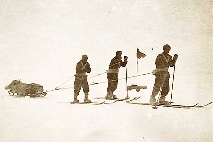
Ross Sea Party led by Aeneas Mackintosh on board the Aurora.
The Ross Sea party was a component of Sir Ernest Shackleton's Trans-Antarctic Expedition 1914–17. The Ross Sea Party had the task of setting supply depots from McMurdo Sound to the Beardmore Glacier to provide supplies for the Trans-Continental party led by Shackleton.
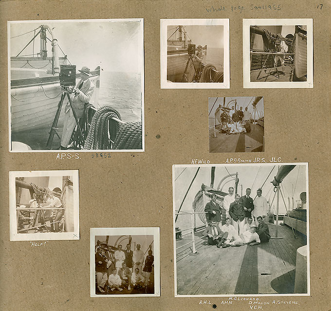
Most of their supplies were on the ship and when she broke free and drifted away from Antarctica they were marooned. They survived by using supplies left in the hut by the Scott expedition in 1912.
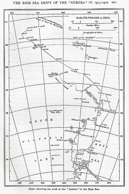
Despite this, atrocious weather and illness caused by poor diet, they continued with the task of depot setting. They covered 1356 miles in 6 1/2 weeks, carrying some 4500lb of supplies, making it one of the longest land journeys undertaken to date.
Before the group were rescued by the refitted Aurora in a relief operation planned by the RGS, three of the party had died including Mackintosh. Shackleton provided an epitaph ‘Things done for gain are not, but good things done endure.’
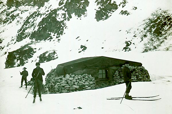
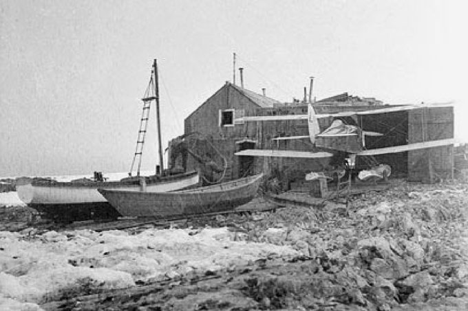
British Expedition to Graham Land led by John Cope.
An ambitious expedition was planned to circumnavigate Antarctica and undertake the first flight over the South Pole. Funding was difficult, so a small four-man party set out. Eventually two men, Bagshawe and Lester were left in Antarctica over the winter, their shelter being a converted water boat in Paradise Harbour, now renamed Waterboat Point. They undertook meteorological and zoological observations and collected data for a whole year for the first time.
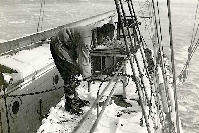
UK Discovery Investigations of the Southern Ocean begin.
These were a series of British funded, scientific studies taking place around the Antarctic Southern Ocean. They were names after R.S.S. Discovery, first used by Scott at the beginning of the 20th Century. The purpose of the investigations was to develop a better understanding of conservation of stocks and the ocean food chain. The investigations continued until 1951 and form the basis of an understanding of modern marine systems. They mark an important stage in British oceanographic studies of the marine ecosystem by employing new techniques in large scale multi-disciplinary study. The investigations were taken up again in the Offshore Biological Programme in 1978. Find out more about these important investigations at Discovery Investigations
Douglas Mawson led the British, Australian and New Zealand Antarctic Research Expedition, or BANZARE for short, on board the Discovery.
British Graham Land Expedition led by John Rymill aboard the Penola.
The aims of the expedition were undertaking scientific research, assessing the economic potential of the area and reasserting British sovereignty in the Antarctic Peninsula. Funding came from the British government, while the RGS and SPRI endorsed the expedition.
The Northern Base was set up on the Argentine Islands off the coast of the Antarctic Peninsula which were of exceptional biological interest. The party then moved south mapping and surveying the coast and setting up the Southern Base in the Debenham Islands, where they made preparations to travel inland during the summer months in George VI Sound, looking for a route to the Weddell Sea and undertaking geological investigations. Their research proved that the area was a peninsula and not an archipelago of islands as had previously been thought.
More information can be found at the Scott Polar Research Institute.
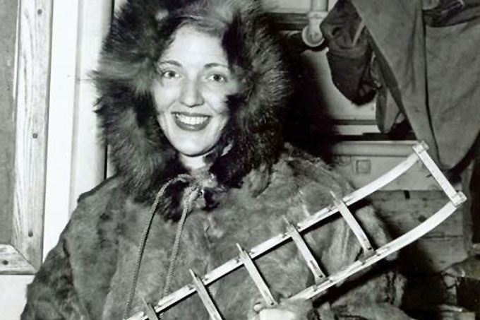
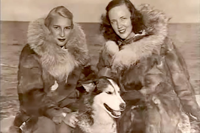
In 1935, Caroline Mikkelsen, wife of a Norwegian whaling captain, became the first known woman to set foot, briefly, in Antarctica.
Operation Tabarin
In 1943 the British Government sent a party to report any enemy naval activities in the Antarctic region. Bases were established on Antarctica for the first time and other bases were rapidly built. As well as maintaining a permanent presence on the continent, exploration, survey and research were carried out. This was the basis for the modern era of research.
Beyond Operation Tabarin
After the end of the war in 1945, Tabarin’s three bases and its scientific work were transferred to a new organisation - The Falklands Islands Dependencies Survey (FIDS). The number of bases was increased and extensive scientific and surveying journey made.
The first women to winter on the continent were Americans Edith Ronne and Jennie Darlington, wives of Ronne Antarctic Research Expedition members in 1947.
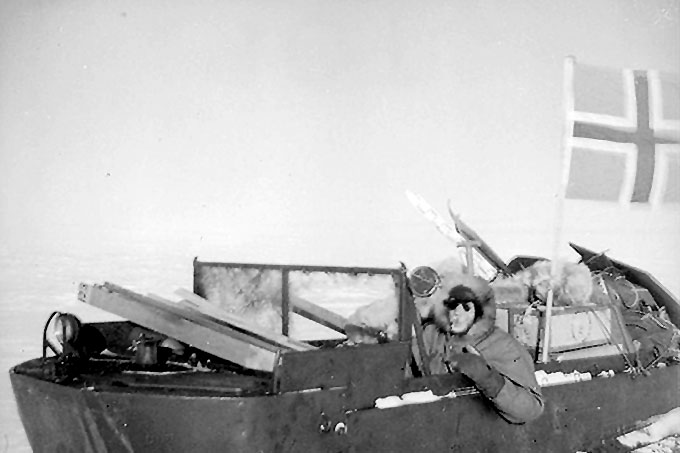
The Norwegian - British - Swedish Expedition (NBSAE) of 1949-52 was the first expedition in Antarctica involving an international team of scientists.
Their main objective was to explore whether the climatic fluctuations observed in the Arctic were also occurring in Antarctica. The party was led by the Norwegian Captain John Giaever, with each country in charge of a different aspect of the expedition.
On 23 February 1951 the expedition was hit by tragedy when three of the expedition died. Poor weather had caused the party in one of the weasel tractors to misjudge they position and they plunged over an ice cliff into the sea. Only one of the four occupants was able to swim to safety reaching an ice-flow from which he was rescued thirteen hours later.
Find out more about the expedition at the Scott Polar Research Institute
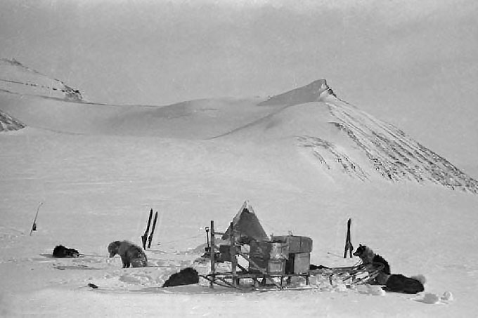
Surveying the Antarctic Peninsula
Researchers describe some of the transport and surveying journeys made at this time. The maps resulting from these surveys provide base maps on which scientists could plot their results and plan future work.
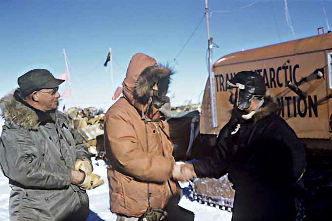
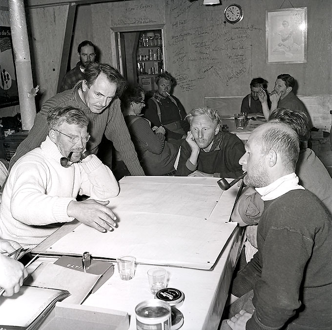
The Trans-Antarctic Expedition led by Sir Vivian Fuchs and supported by Sir Edmund Hillary undertook the first crossing of the Antarctic from the Weddell Sea to the Ross Sea via the South Pole. Sir Vivian Fuchs was sometimes known as Bunny Fuchs.
Although not part of the IGY, valuable scientific research was undertaken. The expedition was not without difficulties. A party of eight men were left at Shackleton base to over-winter and set up the base, but valuable stores were left on the ice during a blizzard and were lost when the ice shelf broke up.
The following summer Fuchs returned and Hillary's team set up Scott Base in McMurdo Sound on the Ross sea.
Fuchs’ job was to set up depots on the Polar Plateau using air reconnaissance and tractors. Hillary continued overland to the South Pole becoming only the third party to reach the Pole overland and the first to do so in vehicles.
Fuchs’ team reached the Pole from the opposite direction on 19 January 1958. Fuchs then continued overland, following the route that Hillary had laid, while Hillary flew back to Scott Base. The overland party finally arrived at Scott Base on March 2, 1958, having completed the historic crossing of 3,473km (2,158 miles) of previously unexplored snow and ice in 99 days. In December 1957 four men from the expedition few one of the planes, making the first non-stop trans-polar flight across the Antarctic continent from Shackleton Base via the Pole to Scott Base, following roughly the same route as Fuchs’ overland party.
International Geophysical Year
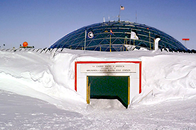
International Geophysical Year was an international scientific project that lasted from 1st July 1957 to 31st December 1958, with all major countries taking part in a variety of different scientific projects. These included research in Antarctica where 12 countries were engaged in research at 52 stations. The Halley Research Station was established in 1956 and the first permanent base at the Scott Amundson Base South Pole in 1957, using air transport as part of the programme. As a result of the international co-operation displayed through the programme, discussions which led to the signing of the Antarctic Treaty were begun.
The Falkland Islands Dependencies Survey was renamed the British Antarctic Survey when the British Antarctic Territory was created as a separate British Overseas Territory following the Antarctic Treaty coming into force in 1961. Find out more about their current activities at the British Antarctic Survey website.
The International Antarctic Glaciological Project saw the first use of radio echo sounding equipment in Antarctica to measure ice thickness.
The start of ongoing British study of the Southern Ocean.
The start of ongoing British study of the Southern Ocean through marine cruises by the Offshore Biological Programme, which later became the Pelagic Ecosystem Studies. These programmes and other international studies use modern methods to reveal the interactions between organisms in the Southern Ocean. This is especially important for the management of the Southern Oceans where a few species, notably krill, dominate the biological process. (See ‘Beneath the Waves’).
Transglobe Expedition led by Randolph Fiennes.
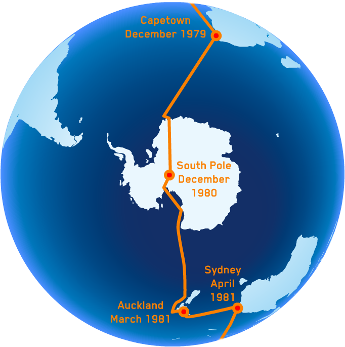
The 100,000 mile route took the Transglobe Expedition team across the Sahara via Tombouctou, through the swamps and jungles of Mali and the Ivory Coast, over huge unexplored crevasse fields in Antarctica, through the inhospitable North West Passage, graveyard of so many famous venturers, and into the unpredictable hazards of the Arctic Ocean. The expedition was in Antarctica from January 1980 to April 1981.
Read more about the Transglobe Expedition.
Using photogrammetry to measure the velocity of glaciers.
Winter Weddell Sea Project.
Steep decline in ozone levels recorded.
British Antarctic Survey scientists published results showing a steep decline in levels of ozone over Halley since the 1970s, particularly during the austral spring and the existence of the ozone hole was revealed. Since then the extent of the ozone hole has been monitored continuously using both ground-based and satellite-based techniques.
Read more about ozone level science at the British Antarctic Survey
Setting up the Antarctic Digital Database (ADD)
Version 6.0 of the ADD went live on 1st June 2012
Ranulph Feinnes and Dr Mike Stroud became the first people to cross Antarctica unsupported.
The last dogs were removed from Antarctica on 22nd February 1994.
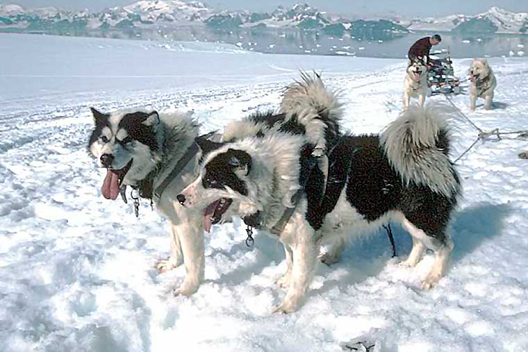
Under the terms of the Antarctic Treaty’s Environmental Protocol all non-indigenous species had to be removed from Antarctica because of the potential threat to indigenous species, for example through the transmission of disease and killing animals for food for the dogs.
Find out more about the removal of sledge dogs
Find out more about environmental issues